Walk across the dam
The site is free to visit: walk across the top of the dam, information panels in French and English, picnic area and restaurant near the car park.
Savoie Mont Blanc, Roselend dam and site


| Day | Lac de Roselend 1,557 m | Wind 1,557 m | |
|---|---|---|---|
| Sun 11 Oct | 4° / 9° | 10 km/h | |
| Mon 12 Oct | 4° / 12° | 11 km/h | |
| Tue 13 Oct | 7° / 14° | 14 km/h | |
| Wed 14 Oct | 8° / 16° | 7 km/h | |
| Thu 15 Oct | 9° / 18° | 11 km/h | |
| Fri 16 Oct | 9° / 15° | 9 km/h | |
| Sat 17 Oct | 5° / 8° | 7 km/h |
Weather-model estimates at the stated altitude of each point, not measurements. Source: Open-Meteo, updated every hour.
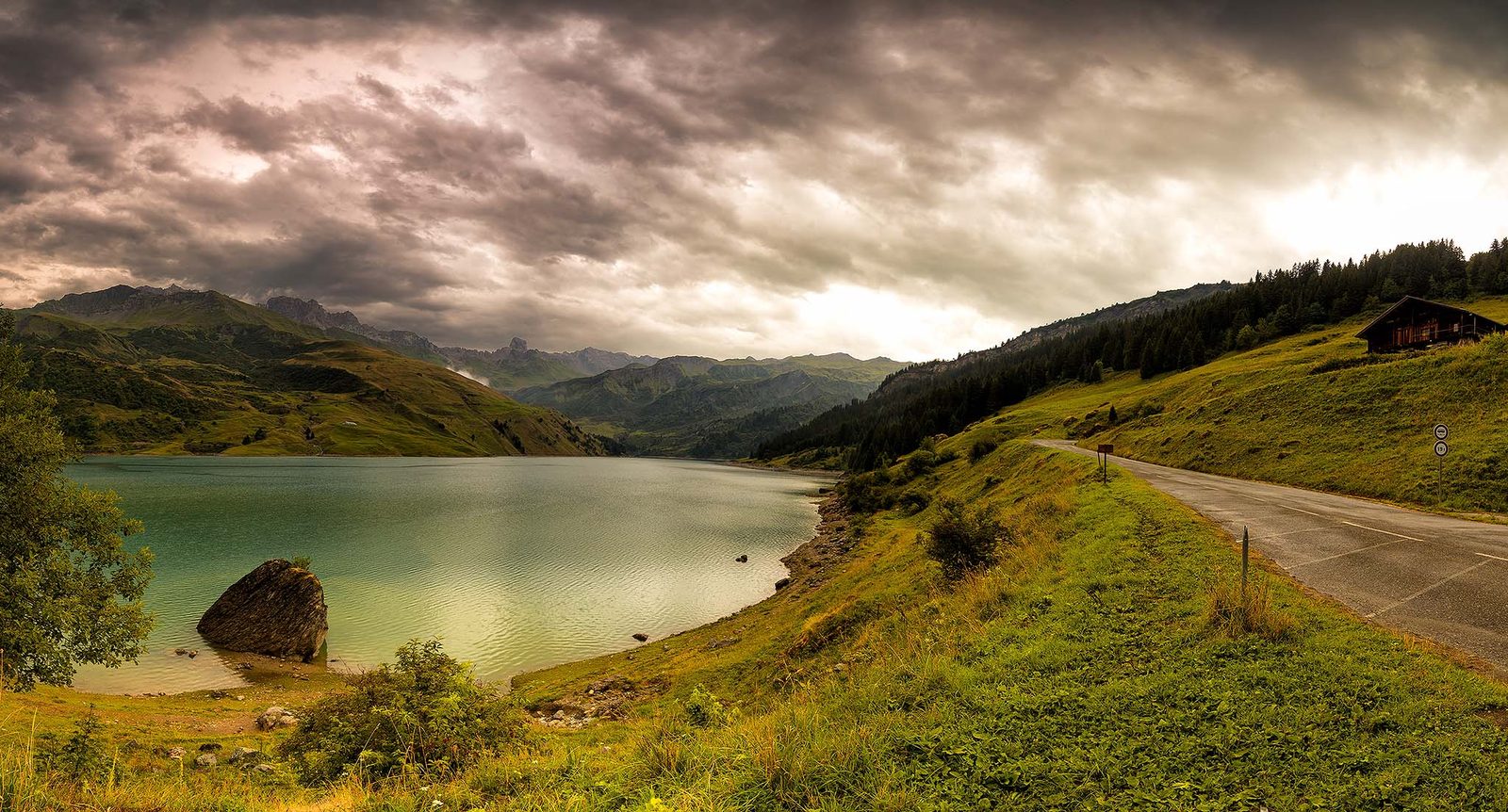
Lac de Roselend is not a natural lake: it is the reservoir of a large dam built by EDF (the French electricity company), first filled in 1960 above Beaufort. The water covered the alpine hamlet that gave the lake its name; only the chapel, beside the road, recalls the village. All around are the summer pastures of the Beaufortain, the Rocher du Vent and, on a clear day, Mont Blanc.
You get there by car or by bike on the D925 from Beaufort, the road that carries on over the Cormet de Roselend pass (1,968 m) to the Tarentaise valley. It is closed in winter, so the lake can only be visited from late spring to autumn. Swimming is not allowed; people come to walk across the dam, picnic, hike or ride over the pass.
D925 to Beaufort (about 35 min), then the same road climbs in hairpin bends to the Col de Méraillet, beside the lake. A steeper variant goes via Arêches and the Col du Pré, then across the dam. Arêches-Beaufort tourist office, getting there
D902 up the Chapieux valley to the Cormet (about 19 km), then down to the lake on the D925. Closed in winter between Les Chapieux and the pass. France Vélo Tourisme, Route des Grandes Alpes by bike: Beaufort – Bourg-Saint-Maurice
A43 then A430 to Albertville, then the D925 via Beaufort: about an hour to Beaufort according to the tourist office, then the climb to the lake. Arêches-Beaufort tourist office, getting there
Train to Albertville, then bus 21 to Beaufort and Arêches. The free summer shuttles of 2026 (4 July – 31 August) went as far as the Saint-Guérin dam, not to Roselend: the last part of the climb is on foot, by bike or by car. Arlysère, Navettes Nature 2026 shuttle timetable (brochure)
Tap a point on the map or in the list to see its description, with a link to get directions from where you are.
You can walk across the top of the dam; the road variant via the Col du Pré runs over the dam itself.
Parking for cars and coaches, toilets, picnic area and restaurant, open in season. No access in winter.
Beside the Cormet road, above the lake: the only reminder of the hamlet flooded in 1960.
French Alpine Club mountain hut (refuge) at 1,818 m on the Cormet road, staffed from mid-June to mid-September. Starting point for the Rocher du Vent and its via ferrata.
The pass towards Les Chapieux and Bourg-Saint-Maurice. Just a car park: no restaurant, no toilets.
Above the south shore of the lake: the shortest way up to the refuge and Lac de Presset.
Small neighbouring reservoir (1,562 m) whose water flows into Roselend.
The nearest railway station on the Beaufortain side; bus 21 leaves from the bus station next door for Beaufort and Arêches (not as far as the lake).
The Haute Tarentaise (upper Tarentaise) station, at the foot of the climb to the Cormet via Les Chapieux (about 19 km).
The site is free to visit: walk across the top of the dam, information panels in French and English, picnic area and restaurant near the car park.
Savoie Mont Blanc, Roselend dam and siteThe climb from Beaufort is part of the Route des Grandes Alpes: around twenty kilometres of ascent to the pass, very busy in summer with cyclists, motorcyclists and vintage cars.
France Vélo Tourisme, Route des Grandes Alpes by bike: Beaufort – Bourg-Saint-MauriceAn 800 m loop in four sections (Nepalese bridge, tunnel, chimney) above the Plan de la Lai, with a walk-in of about 45 min. Full via ferrata kit is compulsory; guided outings are available with the Beaufortain mountain guides.
Arêches-Beaufort tourist office, Roc du Vent via ferrataFrom the lake loop to the passes of the Beaufortain, the lake and the Cormet are the starting point for routes of every level: see the hiking guide below.
Arêches-Beaufort tourist office, the Cormet de RoselendThe Plan de la Lai chalet, run by the French Alpine Club, offers meals and overnight stays while it is staffed (15 June to 14 September in 2026).
FFCAM (French Alpine Club), Plan de la Lai chaletThe lake is popular with anglers; you need a fishing permit. The rules (dates, catch limits) are those of the Savoie fishing federation.
Arêches-Beaufort tourist office, Roselend dam and siteA long loop with no technical difficulty, staying close to the shore, past the chapel and across the top of the dam.
Read the route 8.8 km · 602 m ascent · 4 h 15 minA loop up to 2,337 m for a bird’s-eye view of the Roselend and Gittaz lakes, facing Mont Blanc.
Read the route 10.5 km · 3 hAn easy three-hour loop linking the two reservoirs through alpine pastures and forest.
Read the route 22.4 km · 1,212 m ascent · 9 h 50 minA big, demanding loop from the Cormet to Lac de Presset, at the foot of the Pierra Menta.
Read the route 28.1 km · 1,375 m ascent · 8 hA very long loop with easy mountaineering terrain, via the Combe de la Neuva, Lac d’Amour and the Col du Grand Fond.
Read the route 9.4 km · 634 m ascent · 4 h 30 minA ridge loop above the Saint-Guérin and Roselend dams, with Mont Blanc opposite.
Read the routeA webcam or a forecast cannot tell you whether a beach has lifeguards, a boat is running or a road is open: check with the official sources.
No. The Arêches-Beaufort tourist office says swimming and unsupervised water sports are strictly prohibited. It is a hydroelectric reservoir: the level can change quickly and the water is cold and deep.
From late spring to autumn. The road is closed in winter by order of the Savoie Département (for winter 2025-2026, from 31 October 2025 at 5 pm) and reopened by a new order in spring, usually between late May and June. Check the Département’s traffic orders before you set off.
Only part of the way: train to Albertville, then bus to Beaufort or Arêches. In 2026, the free summer shuttles went up to the Saint-Guérin dam, but no line went all the way to Roselend.
You can walk across its crest and explore the site freely, with information panels. The inside of the dam is not open to the public.
1,557 m at normal water level, according to the dam monograph by the French Committee on Dams and Reservoirs (CFBR). The Cormet de Roselend, at the end of the road, is at 1,968 m.
Text written for AlpeSnow and last reviewed on , based on the sources below (mostly official French pages, in French). Webcam images belong to the credited operators; each photo shows its author and licence (Creative Commons for those from Wikimedia Commons, resized for the site); the forecast is the Open-Meteo model at the lake’s altitude.